1 of 1 copy available
Honor Book for the Society of School Librarians International’s Best Book Award – Social Studies, Grades 7-12
Shortlisted for the Children's Literature Roundtable Information Book of the Year
2003 winner of the Mr. Christie’s Book Award Seal
Shortlisted for the 2004 Norma Fleck Award for Canadian Children’s Non-fiction
Included on VOYA’s ninth annual Nonfiction Honor List
Selected for inclusion in CCBC Choices 2004: the best-of-the-year list published by the Cooperative Children’s Book center of the School of Education at the University of Wisconsin-Madison
Named Notable Book by the International Reading Association’s Children’s Book Award in the intermediate nonfiction category
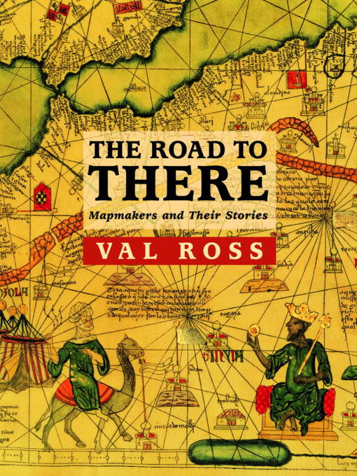
Road maps; sailor’s charts; quilts; songlines; gilded parchment covered with jewel-like colors; computer printouts – to guide us through the strange, vast, beautiful, and mysterious frontiers of the world of maps, Val Ross presents the men and women who made them.
Here are some of the unexpected stories of history’s great mapmakers: the fraud artists who deliberately distorted maps for political gain, Captain Cook, the slaves on the run who found their way thanks to specially-pieced quilts, the woman who mapped London’s streets, princes, doctors, and warriors. These are the people who helped us chart our way in the world, under the sea, and on to the stars.
With reproductions of some of the most important maps in history, this extraordinary book, packed with information, is as fascinating and suspenseful as a novel.
-
Creators
-
Publisher
-
Release date
June 5, 2009 -
Formats
-
Kindle Book
-
OverDrive Read
- ISBN: 9781770490628
-
EPUB ebook
- ISBN: 9781770490628
- File size: 9995 KB
-
-
Languages
- English
-
Levels
- ATOS Level: 8.1
- Lexile® Measure: 1140
- Interest Level: 4-8(MG)
- Text Difficulty: 7-9
-
Reviews
-

Starred review from December 1, 2003
Gr 6 Up-Taking the view that maps " are another way that we can tell stories," Ross presents an intriguing look at several mapmakers and the way that their work reflected not only physical boundaries, but also important aspects of their lives and the times in which they lived. The author introduces Roger II and Al-Idrisi, a Christian king and a Muslim scholar who collaborated to create a planisphere of the world during an era when other Christians and Muslims were killing one another in the Crusades. She describes Cheng Ho, a 15th-century admiral from China who journeyed far until a regime change curtailed his explorations; Henry the Navigator, a Portuguese prince with a passion for discovery who also fathered the slave trade in Europe; and Gerard Mercator, a brilliant cartographer who was arrested for "suspicious religious beliefs" in the 16th century. Other chapters treat the Cassini family dynasty, James Cook, Lewis and Clark, efforts to map the ocean floor, maps created under clandestine conditions, the founder of the A-Z Map Company, and aerial photography. The tone of the text is chatty, sometimes humorous, and never dry. Fact boxes provide tangential information that extends the reading experience. Reproductions of contemporary maps, illustrations, and photos provide a sense of the past, while modern outline maps help youngsters understand the issues. Filled with details and insights and written with a storyteller's touch, this book will simultaneously inform and fascinate readers.-Joy Fleishhacker, School Library JournalCopyright 2003 School Library Journal, LLC Used with permission.
-

December 15, 2003
Gr. 7-10. Ross covers plenty of historical ground in this wide-ranging discussion of maps and mapmakers. Each of the 13 chapters spotlights a different topic--from the voyages of fifteenth-century Chinese explorer and chart maker Cheng Ho to the mapping of North America. Though the discussion includes critical opinions of notables such as Henry the Navigator and Captain James Cooke, the more memorable sections of the book concern lesser-known individuals, such as Phyllis Pearsall, who created a detailed map of London" "in 1936. The book concludes with a chapter-by-chapter bibliography and photo credits for the excellent period illustrations, including paintings, prints, photos, documents, and many maps, reproduced in color. An eclectic presentation, potentially fascinating to young people who are intrigued by maps and their history.(Reprinted with permission of Booklist, copyright 2003, American Library Association.) -

January 1, 2004
Ross brings an unusual immediacy to the history of mapmaking. By starting each chapter with a succinct, vivid description of a moment in history, she crafts readable chapters on cartographers throughout the centuries: from Al-Idrisi, a Muslim mapmaker in 1145, to the English woman who created the London A-Z maps in the 1930s. It is unfortunate that the details of the maps and illustrations are sometimes lost due to their small size. Reading list. Ind.(Copyright 2004 by The Horn Book, Incorporated, Boston. All rights reserved.)
-
October 1, 2004
Gr 6 Up-An intriguing look at several cartographers and the way that their work reflected not only physical boundaries, but also important aspects of their lives and times. Enhanced by reproductions of beautiful and historically significant maps, the well-researched, sometimes wry text will inform and entertain readers.Copyright 2004 School Library Journal, LLC Used with permission.
-